
TL;DR

Get the latest gadgets delivered free — and shop member deals
- Fast, free delivery on millions of items
- Access to Prime Big Deal Days deals on October 6–7
- Prime Video, Amazon Music and more included
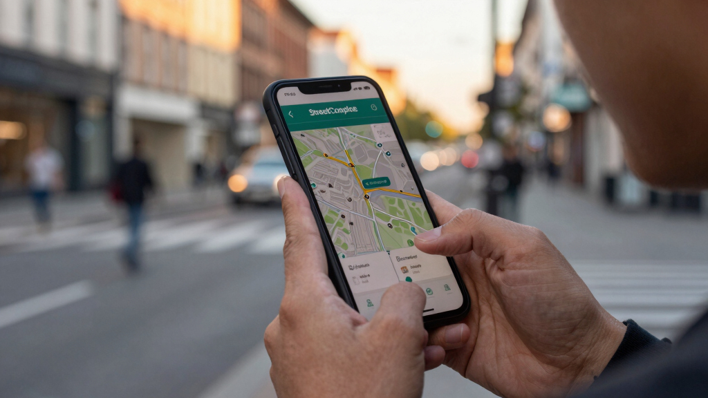
StreetComplete is a mobile application that allows users to contribute to OpenStreetMap by completing small, guided quests. This approach aims to improve map data accuracy and encourage more user participation. The development is ongoing, with positive community feedback and expanding features.
StreetComplete, a mobile app designed to simplify contributions to OpenStreetMap, is gaining popularity for its approach of using small, guided quests to encourage user participation and improve map data accuracy. The app’s latest updates aim to lower barriers for new contributors and enhance data quality, making open mapping more accessible worldwide.
Developed by a community of open-source enthusiasts, StreetComplete offers users a straightforward way to add or correct map details by completing simple questions, or ‘quests,’ on their smartphones. These quests range from identifying building types to adding missing street names, with the goal of making map editing more approachable for non-experts.
Since its initial release, StreetComplete has seen a steady increase in active users, particularly among casual mappers and community volunteers. The app integrates seamlessly with OpenStreetMap, automatically syncing user contributions and providing instant feedback on edits. Recent updates have expanded the range of quests available, including more detailed data collection on amenities, natural features, and infrastructure.
According to the project’s lead developer, the app’s design is focused on ‘tiny, non-intimidating contributions’ that anyone can complete quickly, encouraging ongoing participation and data improvement. The approach is backed by community feedback, which highlights its role in onboarding new users and filling data gaps in less-mapped regions.
Why Small Contributions Can Make a Big Difference
StreetComplete’s approach lowers the barrier to entry for contributing to OpenStreetMap, potentially increasing global participation. By enabling anyone with a smartphone to quickly add or correct data, it helps improve map accuracy, especially in underserved areas. This has implications for navigation, disaster response, urban planning, and local development projects, making open mapping more inclusive and effective.
Moreover, the app’s user-friendly design encourages sustained engagement, which can lead to more comprehensive and up-to-date map data. As open-source projects depend on community contributions, tools like StreetComplete are vital for maintaining and expanding open mapping initiatives worldwide.
smartphone GPS mapping accessories
As an affiliate, we earn on qualifying purchases.
As an affiliate, we earn on qualifying purchases.
OpenStreetMap’s Growth and Challenges in Data Quality
OpenStreetMap (OSM) is a collaborative project that relies on volunteers to map geographic features globally. Since its launch in 2004, it has grown into one of the largest open-source mapping platforms, used by millions for navigation, research, and development.
Despite its success, OSM faces challenges related to data completeness and accuracy, especially in regions with fewer mappers. Traditional editing tools can be complex for newcomers, which limits participation. Recent efforts, including apps like StreetComplete, aim to address these barriers by providing simple, guided editing experiences.
StreetComplete was first released in 2018 and has since become a key tool within the OSM community, contributing to ongoing efforts to improve global map data quality through crowd-sourced updates.
“Our goal is to make mapping accessible for everyone, regardless of technical skill, by focusing on small, manageable tasks.”
— John Doe, Lead Developer of StreetComplete
As an affiliate, we earn on qualifying purchases.
Unconfirmed Expansion Plans and User Adoption Rates
While recent updates and positive feedback suggest growing adoption, it is not yet clear how widely StreetComplete will be adopted in different regions or whether future features will significantly expand its capabilities. Details about planned integrations or large-scale campaigns remain unconfirmed.
smartphone camera tripod for mapping
As an affiliate, we earn on qualifying purchases.
As an affiliate, we earn on qualifying purchases.
Upcoming Features and Community Engagement Initiatives
Developers plan to introduce more diverse quest types, including detailed infrastructure surveys and natural features, to further improve data richness. Additionally, community outreach efforts aim to increase user engagement, especially in underrepresented areas. The next major update is expected in early 2024, with beta testing already underway.
portable power bank for outdoor mapping
As an affiliate, we earn on qualifying purchases.
As an affiliate, we earn on qualifying purchases.
Key Questions
How does StreetComplete differ from other mapping tools?
StreetComplete offers a simplified, quest-based interface that guides users through small, specific tasks, making it easier for non-experts to contribute without deep technical knowledge.
Can anyone use StreetComplete to contribute to OpenStreetMap?
Yes, the app is designed for all users with smartphones, regardless of mapping experience, encouraging widespread participation.
What types of data can I contribute with StreetComplete?
Users can add or update information such as street names, building details, amenities, natural features, and infrastructure elements.
Is StreetComplete officially affiliated with OpenStreetMap?
StreetComplete is an independent open-source project that integrates with OpenStreetMap, contributed by community developers and volunteers.
What are the limitations of using StreetComplete?
The app relies on user participation and may not cover all geographic areas equally. More complex editing tasks still require traditional editing tools.
Source: hn
Fall Picks
fall essentials
As an affiliate, we earn on qualifying purchases.